Browse Webshop > Cartography
Sort by: Title +
Results: 1 - 9
Items per Page: 12 +
![Carte Speciale des Chemins de Fer de La France et de L’Allemagne. Logerot, A [editor]. Carte Speciale des Chemins de Fer de La France et de L’Allemagne. Logerot, A [editor].](../../media/designs/b8/8e/b88e9ae450a4a26e859d1b25d4db6222.jpg)

View Item
Carte Speciale des Chemins de Fer de La France et de L’Allemagne.
Publisher: Auguste Logerot, Paris,
Date of publication: 1875
£45.00
French text, no publication date stated circa 1875. Map approximately 90x69 cm, dissected into 32 parts and mounted on linen; routes and countries marked in colour with different colours to differe...
Read more

View Item
Cary's New Map of England and Wales with Part of Scotland.
Publisher: J Cary, London;
Date of publication: 1794
£425.00
FIRST PRINTING. Quarto, pp. [10] including letterpress and engraved title page, 78 leaves of maps as called for including General Map to fore, 85 Index, [3] List of Subscribers. The maps are on sca...
Read more


View Item
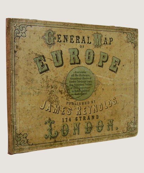
General Map of Europe.
Publisher: James Reynolds, London;
Date of publication: 1855
£450.00
[1855]. Map of Europe, 46 x 37 inches approx, drawn by E Ravenstein with borders hand-coloured in outline; dissected and mounted onto linen. Housed in quarter maroon cloth, recased using original p...
Read more

View Item
Map of the Coalfield of Northumberland Showing the Royalties of Collieries, Railw...
Publisher: Andrew Reid & Company, Limited, Newcastle upon Tyne;
Date of publication: 1931
£85.00
FIRST EDITION. Map lithographed in colour,approximately 95 cm x 65 cm. Scale of 1 inch to 1 mile with 4 inset sections in differing scales. Dissected into 25 sections and mounted upon linen, folded...
Read more

View Item
Map of the North Eastern Railway and Connections 1910.
Publisher: Chorley & PIckersgill, Leeds & London;
Date of publication: 1910
£175.00
Map approximately 113 cm x 89 cm, printed in colour and dissected into 25 sections, mounted onto linen and folded inside covers approximately 24 cm x 19 cm. Full black calf with gilt titles to uppe...
Read more

View Item
Map: Survey of India [40 mile].
Publisher: Survey Office of India. Shillong;
Date of publication: 1952
£125.00
SECOND EDITION. Map approximately 178 cm x 167 cm, folded into cream card covers with brown titles and crest. Scale 40 miles to One Inch with features, boundaries and routes marked in colour; inset...
Read more


View Item
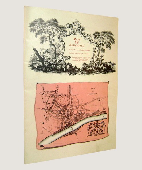
Maps of Newcastle
Publisher: Frank Graham, Newcastle Upon Tyne;
Date of publication: 1984
£25.00
Folio. Unpaginated, 24 pp. Illustrated throughout. Book Condition: Very Good. Large-format booklet in stapled card wraps. Maps and estate plans, including rare eighteenth & nineteenth century maps...
Read more

View Item
The Penguin Atlas of Medieval History.
Publisher: Penguin Books, Harmondswortrh, Middlesex;
Date of publication: 1961
£25.00
FIRST EDITION. Softcover landscape octavo, pp 96. Illustrated throughout including 40 full-page maps by John Woodcock as called for, with seas marked in blue. Pictorial laminated card wraps. Spine...
Read more

View Item
Rare Map of South Wales. A New and Accurate Map of South Wales.
Publisher: Printed for Carinton Bowles and Robt Sayer, London;
Date of publication: 1760
£3000.00
Second Edition, n.d. but circa 1760. Map approx 158 cm x 113 cm, dissected into 32 parts and mounted onto linen. Uncoloured. Large title cartouche to upper left corner with allegorical figures and ...
Read more
Results: 1 - 9

Back to top
Browse Webshop
All Titles|Recent Acquisitions|Agriculture|Aircraft|Angling|Anthropology|Antiques & Collecting|Archaeology|Architecture|Art|Art & Design|Astronomy|Autobiography|Aviation|Biography|Bookbinding|British Topography|Cartography|Cartoon Strip|Chapbook|Children's|Classics|Comics|Cookery|Cookery & Entertaining|Correspondence|Crafts|Crime & Criminology|Drama|Education|Engineering|Entertainment|Equestrian|Erotica|Essays|Fashion|Fiction|Fine Bindings|Freemasonry|Games/ Hobbies|Gardening|Gender Studies|Geography|Geology|Graphic Novel|Graphics|History|History - USA|Hobbies|Horology|Humour|Illustrated|Language|Literature|Local History|Magic|Maritime|Maritime History|Martial Arts|Mathematics|Medical|Military|Military History|Modelling|Modern Firsts|Mountaineering|Music|Myths & Legends|Natural History|Naval History|Occult|Periodicals|Philosophy|Photography|Physics|Poetry|Politics|Printing|Private Press|Prose|Reference|Science|Science & Technology|Science Fiction|Sport|Sport - Cricket|Sport - Football|Technology|Theatre|Theology|Theology & Religion|Topography|Trade & Industry|Transport|Travel & Topography|Travel & Topography - England|Travel & Topography - London

